subLOGIC Scenery Disks
| subLOGIC Scenery Disks | ||
|---|---|---|
 | ||
| Game No. | 356 | |
| Voting | 6.00 points, 7 votes | |
| Developer | Michael Woodley, Loren Kirkwood, Michelle Maase, Ken Ruminski, Toni Arcus | |
| Company | subLOGIC | |
| Release | 1985 - 1989 | |
| Platform | Amiga, Apple II, Apple MacIntosh, Atari 8-bit, Atari ST, C64, MSX, PC, TRS-80 | |
| Genre | Simulation, Flight (Civil) | |
| Gamemode | Single player | |
| Operation | ||
| Media | ||
| Language | ||
Description[edit | edit source]
With the scenery disk did subLOGIC provide a series of additional programmes for the flight simulator. subLOGIC scenery disk can be used with the following programmes:
- Flight Simulator II / Flight Simulator II by subLOGIC
- Microsoft Flight Simulator
- subLOGIC Jet
The subLOGIC scenery disks cover the complete area of continental USA, Hawaii and parts of Europe and Asia. They were developed with the help of the official maps of the NOAA (National Oceanic and Atmospheric Administration: Sectional Aeronautical Charts and Airport/Facilty Directories). In each map sector you find the exact dates about all the airports and runways as well as data about the radionavigation. Furthermore, the sector maps show all topographical information and potential obstacles that are relevant for pilots. The data bases for the scenery disks were digitalized from these NOAA sector maps.
The team of developers:
- Scenery Disk Design, Tool Development: Michael Woodley
- Scenery Art: Loren Kirkwood
- Maps and Directories: Michelle Maase, Ken Ruminski, Toni Arcus
Design[edit | edit source]
All scenery disks have enough radionavigation facilities (beacon) and visual information, to ensure a realistic navigation with the chosen air space. A normal scenery disk (SD) covers three sectors and with this has over 100 airports and radio facilities. Some scenery disks can of course contain more than the 'usual' 100 airports, especially in the US states or countries with a higher population density (as e.g. Germany). Also here every scenery disk corresponds to the actual conditions and therefore is ideal for the realistic simulation oft cross-country flights.
Hints[edit | edit source]
Source: subLOGIC - Documentation
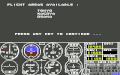
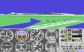
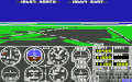
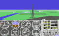
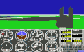
Loading a scenery disk (Commodore 64/128)[edit | edit source]Load the flight simulator II as usual. When the loading is finished change to the editor. For this follow the instructions in your manual. Now adjust the NORTH and EAST coordinates to the airport you wish to use and set the ALTITUDE coordinates to zero. The exact coordinates can be taken from the enclosed maps and sector registers. Now leave the editor and take out the Flugsimulator II disk from the drive and place your scenery disk. Press CTRL E, so that the corresponding landscape data can be loaded. Now a list of the sectors that are contained on the scenery disk appears on the screen. By pressing any key you now get to the airfield of your choice. If no landscape can be seen on the screen, please activate the radar screen and try to find your rough position by zooming backwards. After further zooming out an image of the total continental USA with highways and the five big lakes in the north possibly appears: There was probably a mistake when entering the coordinates (coordinates were not contained on the inserted scenery disk) and the programme automatically loaded the standard database. To get away from the standard programme specification again, you need to go to the editor again and enter the correct coordinates. As soon as you are on the airport of your choice, it is recommended to save your position as a user-mode (see section "User Modes" in the manual). By this it is possible to return to the chosen airport also after a crash. Otherwise you will find yourself always at a position given by the programme after a crash (north of Lake Michigan). The subLOGIC "Flight Simulator" as scenery disk[edit | edit source]The following sectors are on the "Flight Simulator" scenery disk: Chicago, Seattle, Los Angeles and New York. These sectors can be loaded as any other scenery disk database. By this the sectors cannot only be used for the "Flight Simulator", but also for the interceptor simulation JET. Flying over sector borders[edit | edit source]Two things can happen when you cross a sector border: If the adjoining sector is also on the inserted SD, it is automatically loaded - whereby you now have to turn your attention towards the new sector map. If the new sector is not on the SD, the standard database is automatically loaded. Important: If you want to change the scenery disk or return to the landscapes of the FS2, you need to load the new disk again by pressing CTRL E. In the editor-controlled versions of the flight simulator a list of the sectores contained on the disk appears again: By pressing any key you get back to the flight mode. Hints for JET users[edit | edit source]All scenery disks are compatible with the JET simulation. Simply follow the instructions in the JET manual. As JET cannot load new scenery disks automatically, you need to return to the start menu with every newly inserted scenery disk. If you insert a scenery disk during a flight, this can lead to a system crash when the next access of the programme is done. |
    |
Overview of the scenery disks[edit | edit source]
SD1 to SD12 - USA[edit | edit source]
Released: 1985.
These 12 planned scenery disks cover the conterminous USA. Each SD covers a geographical region of the USA consisting of 2 to 4 FAA Sectional Charts.
   West                 East

1. Dallas - Ft. Worth      7. Washington
   Houston                    Charlotte
   San Antonio                Jacksonville
   Brownsville                Miami
2. Phoenix                 8. Memphis
   Albuquerque                Atlanta
   El Paso                    New Orleans
3. San Francisco           9. Chicago
   Los Angeles                St. Louis
   Las Vegas                  Cincinnati
4. Klamath Falls          10. Billings
   Seattle                    St. Paul - Minneapolis
   Great Falls                Green Bay
5. Salt Lake City         11. Lake Huron (Huron-See)
   Cheyenne                   Detroit
   Denver
6. Omaha                  12. Halifax
   Wichita                    Montreal
   Kansas City                New York
SD 1-6 were also released as scenery collection in an edited volume. SD 8 and SD 10 were never completed or released.

SDS1 - STAR Scenery San Francisco[edit | edit source]

Released: 1986.
This scenery covers a small area with relatively dense scenery and is mainly intended for VFR flight. It contains many buildings and sights as well as additional details in the main airports. If you leave the area of the SDS1, you get to the SD3, which is also contained (without documentation), to ensure a smooth crossing. Within SDS1 only radionavigation facilities of this scenery can be reached (exceptions: Pajar NDB, Sausalito VOR, Travis VOR). Outside of the SDS1 you can receive radio stations of the SD3. The following radio station are available in both areas:
Woodside VOR           Concord VOR
Sausalito VOR          Pajar NDB
Scaggs Island VOR      Travis VOR
Point Reyes VOR        Sacramento VOR
All other ILS, ATIS and radionavigation facilites of the SDS1 do not exist outside the borders of the disk, as
Oakland VOR
San Francisco VOR
Reiga NDB
San Jose VOR
For the first time there is a new fog display on this disk. To switch on ground fog enter:
CLOUD LAYER 1 TOPS:     7
CLOUD LAYER 1 BOTTOMS:  5
3D objects as buildings, mountains and bridges stay visible atop of the fog. To find out the position of the plane after landing in the fog, you need to use "radar".
SD13 - Japan[edit | edit source]
shows in detail the landscape between Tokyo and Osaka.
-
 SD13 Japan list
 -
 SD13 Tokyo Haneda


SD14 - Western European Tour[edit | edit source]
Released: 1987-1988.
The SD14 contains parts of England, France and Germany. In England is the south and the surroundings of the London centre, in France is the northwest and the surroundings of the Paris centre and in Germany is the area south of the Main from Frankfurt to Munich covered with detailed data. Airports with details:
Bournemouth, Cardiff, London-Heathrow, Luton, Norwich
Caen, Le Tourquet, Lille, Paris Charles de Gaulle
Frankfurt, Munich-Neubiberg
Contained is also a map with navigation facilities outside the detailed areas. It comprises the area from Aberdeen (Scotland) to Martigues (French Riviera) and from Shannon (Ireland) to Berlin-Tegel (Germany). Added are some further scenery details from Europe:
Helsinki (Finland) 22508/19462 with the possibility to refuel.
Moscow with the Kremlin, the Red Square and other details
You find Moscow from 21739N 22124E to the southeast (in 45 minutes with 130 Knots at 5000 Feet).
-
 Airport London Heathrow
 -
 Paris with Eiffel Tower
 -
 Telecommunication tower in Frankfurt
 -
 City center of Munich


SAHA - Hawaiian Odyssey[edit | edit source]
Released: 1989.

On the "Hawaiian Odyssey" Scenery Adventure Disk you see very true in details the 9 main islands of the volcanic archipelago. The islands of Hawaii have 26 airports. Many have VASI (Visual Approach Slope Indicator) - a visual system of landing lights.
- The scenery disk contains an adventure in which you have to follow lots of hints around the whole island to find a hidden treasure.
- If you fly into the crater of Kilauea on the big island, you get into a time tunnel and are automatically placed on an arbitrary point at which you might see a ship from the 17th century or other impossible things. (Per box: "Transporter IBM Microsoft FS3 only. Scenery included with all computer versions.")
Solution[edit | edit source]
- Solutions and tips for each flight simulator with which the scenery disks are used apply also to them.
Cheats[edit | edit source]
- Cheats are presently not known and do not really make sense.
Voting[edit | edit source]
| Voting of the C64-Wiki users (10=the best vote): | ||
| 6.00 points at 7 votes (rank 877). You need to be logged in to cast a vote. | ||
| C64Games | 8 | 2nd January 2008 - "Super" - 17100 downs for 13 disks |
Reviews[edit | edit source]
H.T.W: "This very well elaborated detailled Scenery Disks are a good expansion for the flight simulators Flight Simulator II and The Jet. However, with 20€-30€ per Scenery-Disk they were not that cheap.".
Miscellaneous[edit | edit source]
Cover[edit | edit source]


Disk-Label[edit | edit source]


Highscore[edit | edit source]
No highscore possible.
Links[edit | edit source]
Download:
- c64games Flightsimlator II and sceneries,
 with documentation (Airport Dir., maps etc.)
 - Gamebase64.com - Game No. 2810 ZIP file with Flight-Simulator II and sceneries
- arnold64 Flight Simulator Addon ZIP file with sceneries
Infos:
- MobyGames - subLogic's Flight Simulator Scenery Add-Ons overview and cover
- Flight Simulator II at MigMan